Looking Ahead from A Very Muddy Place

As the climactic battle draws near, we’re picking up the pace this month in A Very Muddy Place. Private Potts has no idea that this is his itinerary for the rest of September—a hundred years ago:

September 12—In Reserve at Saint-Mihiel

16—Special Job for Private Potts

19—A Potts Family Day of Thanks

24—Planning the Meuse-Argonne Offensive

25—Prelude to Battle

26—Taking Vauquois

26—The Fog of War

27—Night Attack

28—Montrebeau Wood

29—Charge to Exermont

29—Clyde Brake Boards the Leviathan

30—The Engineers’ Line

October 8—Roy Albert Buried Alive!

Plan of Attack, First Army


A Very Muddy Place

My great grandfather, like many veterans, didn’t talk much about his wartime experience. His family has only his discharge paper and a few anecdotes.

One hundred years later, I’ve discovered a few documents that bear his name. From draft registration to discharge, I’m following the paper trail of B. F. Potts’s journey to the battlefields of the Great War in France and back home again.

Previous articles:

The Butte of Vauquois

“Well, Daddy, what did you think about France?”
“It's a very muddy place.”

Benjamin Franklin Potts Registers for the Draft

As the Great War thundered across the fields of northern France, ten million American men, ages 21 to 30, signed their names to register to be drafted into military service.

Military Induction and Entrainment

“I, Benjamin Franklin Potts, do solemnly swear to bear true allegiance to the United States of America, and to serve them honestly and faithfully, against all their enemies or opposers whatsoever…”

Army Training at Camp Gordon

“If it moves, salute it. If it doesn’t move, paint it!”

Embarkation, the Tunisian, and the Bridge of Ships

In his first ocean voyage, B. F. Potts crossed the submarine invested waters of the North Atlantic in a convoy of steamers escorted by a warship.

Enterprise, Tennessee: The Town That Died

Grandpa owned matched pairs of horses. Him and the boys [Ben and his brothers] cut and snaked logs out of the wood to the roads. He got a dollar a day plus fifty cents for the horses.


Continue ReadingLooking Ahead from A Very Muddy Place

Enterprise, Tennessee: The Town That Died

My great uncle John Wesley Potts, one of Ben Potts’s boys, was the family genealogist. To him the Potts family is thankful for much of the information we have concerning our family history. I have several photocopied pages of the family tree, which includes old photographs and a few stories. These last are in Uncle Wesley’s words, typed by his hand.

I’m fond of one story in particular. It reminds me of my favorite Dr. Seuss book, and like The Lorax, it remains pertinent. Furthermore, as it gives context to the childhood of our present subject, I think it appropriate at this point to transcribe the story of a town named Enterprise as told by John Wesley Potts.

Enterprise, Tennessee:
The Town That Died

Enterprise was a sawmill town on the banks of Lewis Branch. Around 1900, there were sawmills, stave and shingles. The town was aptly named because it was growing. It grew in size between 200 and 300 people.

The timber was plentiful. Virgin oaks, beach and hickory.

Grandpa Albert Jack Potts moved his family there in 1901 from Slayden, Tennessee.

Grandpa was a teamster. He owned matched pairs of horses. Him and the boys [Ben and his brothers] cut and snaked logs out of the wood to the roads. He got a dollar a day plus fifty cents for the horses.

In a few short years the timber was cut and the town slowly fell apart, much like the lumber towns of upper Michigan. He stayed in Houston County and bought a farm. He lived there until his death at 64, in 1929. Albert and Lou Ellen are buried in the McDonald Cemetery along with four of their children.

Pa would marvel at the way they lumber today.

John Wesley PottsJohn Wesley Potts, 1927-2015


A Very Muddy Place

My great grandfather, like many veterans, didn’t talk much about his wartime experience. His family has only his discharge paper and a few anecdotes.

One hundred years later, I’ve discovered a few documents that bear his name. From draft registration to discharge, I’m following the paper trail of B. F. Potts’s journey to the battlefields of the Great War in France and back home again.

Previous articles:

The Butte of Vauquois

“Well, Daddy, what did you think about France?”
“It's a very muddy place.”

Benjamin Franklin Potts Registers for the Draft

As the Great War thundered across the fields of northern France, ten million American men, ages 21 to 30, signed their names to register to be drafted into military service.

Military Induction and Entrainment

“I, Benjamin Franklin Potts, do solemnly swear to bear true allegiance to the United States of America, and to serve them honestly and faithfully, against all their enemies or opposers whatsoever…”

Army Training at Camp Gordon

“If it moves, salute it. If it doesn’t move, paint it!”

Embarkation, the Tunisian, and the Bridge of Ships

In his first ocean voyage, B. F. Potts crossed the submarine invested waters of the North Atlantic in a convoy of steamers escorted by a warship.

Next date:

September 7—Rendezvous with the 35th Infantry Division

Continue ReadingEnterprise, Tennessee: The Town That Died

Rackham’s Zelkova

They were colleagues, associates, students—friends of a man. They met at the top of the world, where the mountain peaks meet, where the air is pure and spare. Then they climbed yet higher. Evening light stretched long across a lower plain, threw darkness to the depths of a narrow gorge, and set the sky aglow.

Led by a priest, who held his robe by the hem as he went, the pilgrims walked in single file. They traced a path the man had often walked—there above, where the spirit soars and, so, refills. They stepped up stones carved by ages. They tread on earth gathered by last year’s rain. They rounded an ancient well, its domed ceiling fallen. Its stones now hid beyond reflections on dark water.

At length, they came to a rare forest. Tangled roots joined to knotted trunks. Trunks spread to arching boughs, clothed in crenelated leaves. The priest halted beneath the largest tree. The breathless pilgrims congregated round its wide trunk, sheathed in weathered bark. The tree’s branches embraced them. Its roots, like seats, invited them to rest a while, to refill the spirit.

The pilgrims stood in dappled light. Some spoke of the tree and of the man: of the tree’s age, its qualities, its meaning to the man; of the man’s wisdom, his knowledge, his generosity, and his passion for trees.

The priest lit incense in a censer and began to chant. A cool breeze blew, rustling leaves and grasses, mixing a forest perfume of incense, faint asphodel, and dry-dirt dust. The congregation swayed to the rhythmic chant. Goat bells jangled out of sight. The sound, like water tumbling down a mountain stream, joined the chanting as a choir.

The priest concluded the ceremony, lifting the cloth from a plaque: a dedication of the tree to the memory of the man.

Spirits refilled, the congregation dispersed. Descending in groups of twos and threes, they left the tree, now, by their investment, made unique among all the trees of the rare forest.


At the top of the world, where the mountain peaks meet, where the air is pure and spare, you may find a path that climbs yet higher. When evening light stretches long across the lower plain, throwing darkness to the gorge, you may follow the path, where the man once walked—the man who taught us about trees and forests.

At path’s end, you might rest a while in the tree’s embrace. In dappled sunlight, feel the cool breeze, smell the asphodel, hear the goat bells like a tumbling stream. And there above, a filled spirit lingers. 

Oliver RackhamOliver Rackham, 1939-2015

Zelkova abeliceaZelkova abelicea, circa 1300-

Dedicated August 6, 2018, Xyloskalo, Omalos, Crete
Photographs courtesy of Jennifer Moody


Continue ReadingRackham’s Zelkova

Potamida, Ancient Cretan Village

Regional vases at the Archaeological Museum of KissamosA Potamida vase (lower left) on display at the Archaeological Museum of Kissamos

From as early as the seventh century BC, craftsmen of a river bank settlement took white clay from nearby hills to make pottery. The style, unique to the settlement, produced a simple, squat vase with sturdy handles. An example is held at the Archaeological Museum of Kissamos, along with similar wares from other regional towns.

Today, a village named Potamida, after the Greek word potam for “river,” straddles a seasonal stream. A disused footbridge crosses the watercourse amid a jungle of bamboo, grapevines, and fig trees just below the modern bridge.

The clay hills, called Komolithi, sit above the village. Similar white clay can be seen in a thick, geologic layer all along Crete’s north coast. At Komolithi, embedded fossils of microscopic sea creatures indicate it was once a seabed. Only in two places, here and near Sitia in eastern Crete, has erosion produced such magnificent forms in the friable rock. The slender buttes reach up as high as 20 meters beneath shrubby caps.

White Hills of KomolithiKomolithi

The site has become a tourist attraction, though little visited. Perhaps this is best. Wind and rain will wear it away soon enough.

Another local attraction is the watermill, which is marked with a sign from the road. The mill, reconstructed in 2013, lies down a narrow path beside the home of Marika, who holds the key, should it be locked.

A chimney-type watermillWatermill

Marika is an ancient woman, stooped by age so low to the ground one must bend at the waist to shake her hand. When you do, she’ll peer up and flash a wide grin. Then she’ll treat you like an old friend, chattering in Greek. Whether you speak the language is of no consequence whatsoever. You’ll understand that Marika wants you to sit down and enjoy homemade cakes while she retrieves the iron key.

The door to the watermill should be closed, though it’s rarely locked. Inside, wall displays explain its workings. In addition to the olives that have taken over since World War II, Cretan farmers harvested crops of wheat and corn from ancient times. The grains were ground at windmills and watermills scattered around the island.

This one is a “chimney” watermill. A narrow canal, called a leat, diverts water from the stream higher up the valley. The leat is gently sloped to bring water to a point above the mill. The water then falls down a near-vertical shaft, like a chimney, and shoots out a nozzle two meters (6 feet) below the mill house. The spurting water turns a horizontal wheel. Its axle turns the millstone above.

Saint Peraskevi's ChurchSaint Peraskevi’s Chuch, Potamida; Peraskevi is the patron saint of eyes

Saint Peraskevi’s Church of Potamida is not so much an attraction as it is a curiosity. Not so much the church as its bell tower, which has a clock on each of its four faces, all showing different times, none correct. Not so much the tower as its bell that rings the hour every hour… at precisely eight minutes past. In Crete, even the Greek Orthodox Church is on island time.

Opposite the church is a ruin. Carved lintels still hold open windows in stone-block walls. The interior is filled with similar stones, fallen from ceilings and upper floors. Medieval plaster clings in a haphazard pattern. Central arches resist decay. Nothing remains to hint at a construction date, much less to tell us when the wooden door, now dust, was last closed.

Venetian manor house  secret schoolVenetian manor house, secret school

During the Ottoman occupation (1669-1898), Christians were forbidden to school their children as they were used. The now-ruined building, which had been a Venetian manor house, was used as a secret school.

Door with murder holeFacade, fortified palace

Atop a western hill overlooking the village, the Ottoman pasha’s fortified palace crumbles, year by year, into a pile of stones, held together by the roots of fig trees and caper plants that choke the interior. It, like the secret school, would have been in use until 120 years ago.

An archwayInside the ruins, an archway yet stands

Just outside the village is the home of two fine folk, David and Juliet, an English couple, who settled in Crete 20 years ago and built a house from the ruins of The Old Olive Mill. They teach yoga and invite friends and artists to stay in extra rooms. This summer they host yours truly as writer in residence.

800-year old olive treeIn front of The Old Olive Mill, an 800-year old olive tree still bears fruit and serves as support for a climbing trumpet vine

Continue ReadingPotamida, Ancient Cretan Village

A Dark Hole on Zovigli Hilltop

“In one corner, a two-foot square opening in the floor captures one’s attention. Four rusty rungs set into the stone lead down a few feet. Below that, only a flat rock floats in cool darkness.”—from Exploring Zovigli

Ruin atop Zovigli

A dark, square hole in the floor of a ruin on a hill piqued my curiosity. The first time here, I was ill equipped and alone. So, with intrepid friends, Helen and Neil, I returned a month later to Zovigli hilltop at Akrotiri Spada. Neil brought rope and a pair of sneakers almost large enough for my feet. I carried the sneakers, tied together over a shoulder. We hiked to the summit along a faint, switchback trail on Zovigli’s east flank.

While Helen and Neil took in the magnificent view, I looped the rope around the first rusty rung and pulled with my weight to make sure the rung would hold. It did. Sneaker shod, armed with a small flashlight, and with two safety observers now present, I lowered myself down, testing each rung as I went.

Savety observers

Helen and Neil survey the descent

It’s a unique sensation: feeling your way down in darkness, toes reaching for the next hold, exposed to any looming danger. Perhaps decades had passed since anyone had been down here. What did they leave? What happened since? What waits in the dark?

The most dangerous thing I could imagine was a wild animal, recently fallen in the hole. A trapped badger in close quarters, scared and desperate, might shred my legs and rip off a sneaker before I could scramble out of reach.

The scariest thing I could imagine was a skeleton. Human or otherwise, the moment light catches curved bones and empty sockets would be a heart-stopper.

Rough hewn rock

Rough hewn rock walls

Ten feet down, the hole opened up into a small space only a few feet deep. Large rocks covered the bottom in an uneven mound. With outstretched arms, I could almost touch the rough hewn walls on opposing sides. I guessed it to be a bomb shelter.


There were no badgers, no skeletons—nothing of interest whatsoever. To be sure, I displaced a few rocks, exposing black, damp dirt in two separate places, finding only spiders and snails.

“Satisfaction of one’s curiosity is one of the greatest sources of happiness in life.”—Dr. Linus Pauling

Emerging

Continue ReadingA Dark Hole on Zovigli Hilltop

Exploring Zovigli

“When you’re curious, you find lots of interesting things to do.”—Walt Disney

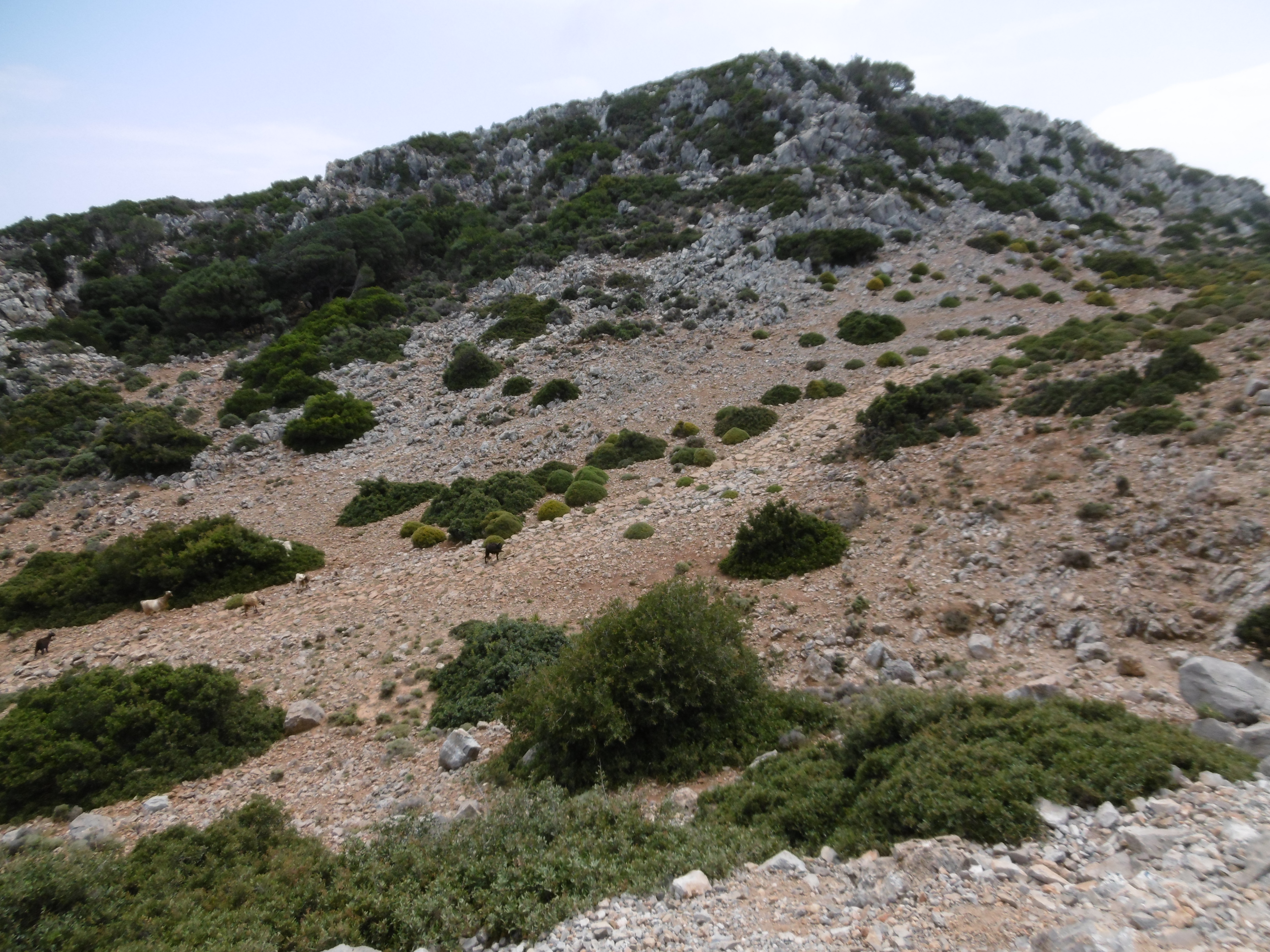
Akrotiri Spada is the northernmost point of Crete and the very end of Rodopou Penninsula. It’s marked by Zovigli, a conical hill that rises 70 meters above the surrounding terrain, which is 300 meters above the sea. Evenly spaced around the northern half of Zovigli’s base, oval shadows belie cave openings, the objective of our present expedition.

Zovilgli hilltop at Akrotiri Spada

Zovigli hilltop (upper right), elevation 370 meters

Lightly clothed against unseasonal April heat, wearing a hat and sunscreen against the rays, I carried in pockets a camera, a small flashlight, a pocket knife, and the dumbphone. A one-hour drive along a rough, gravel road took me to the start point, a lone farmhouse near the end of Rodopou.
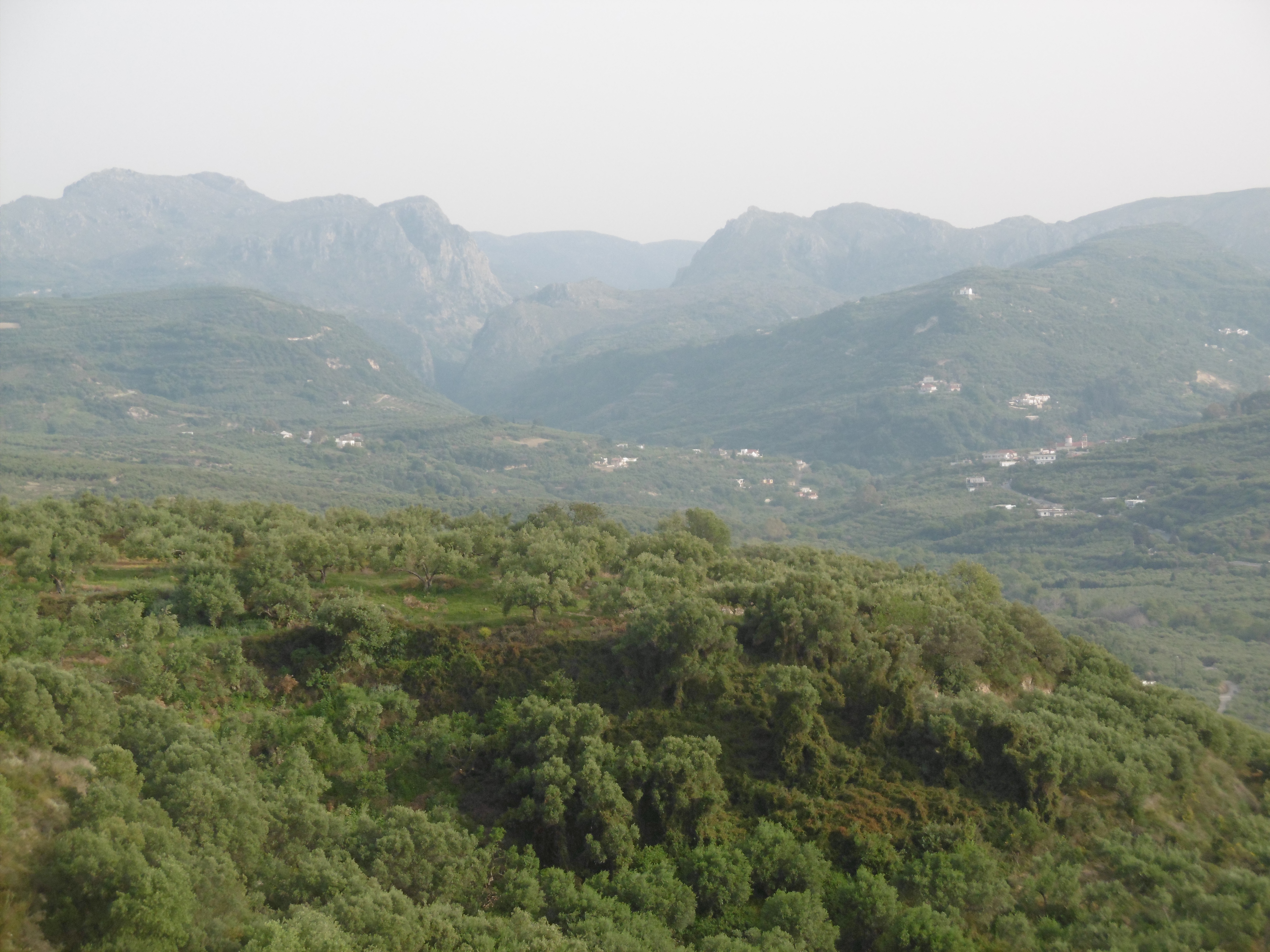
Peninsulas Gramvousa (left) and Rodopou define Kissamos Bay

Peninsulas Gramvousa (left) and Rodopou define Kissamos Bay

Akrotiri Spada is named after its shape on a map. In Latin characters, the Modern Greek spelling is Spatha, which means “broad blade” or “sword,” and akrotiri means “cape.” Exploring is more fun in a place called Sword Cape.

A dirt track, impassable by car, leads two kilometers to the peninsula’s point. There, the hill is surrounded by several structures, including an empty concrete building, the remains of two stone-built towers, and a goat pen, the inhabitants of which roam free across the rocky landscape. The concrete building is certainly a wartime construction, built by German soldiers during the WWII occupation of Crete. The two round towers, both on the cliff’s edge overlooking the sea, were used by the Germans, but they may have been built earlier, possibly by the Venetians.

Ruined stone tower overlooking the Sea of Crete

Looking west from the point of Akrotiri Spada, a ruined stone tower overlooks the Sea of Crete; beyond is the point of Gramvousa Peninsula

Thorny cushion

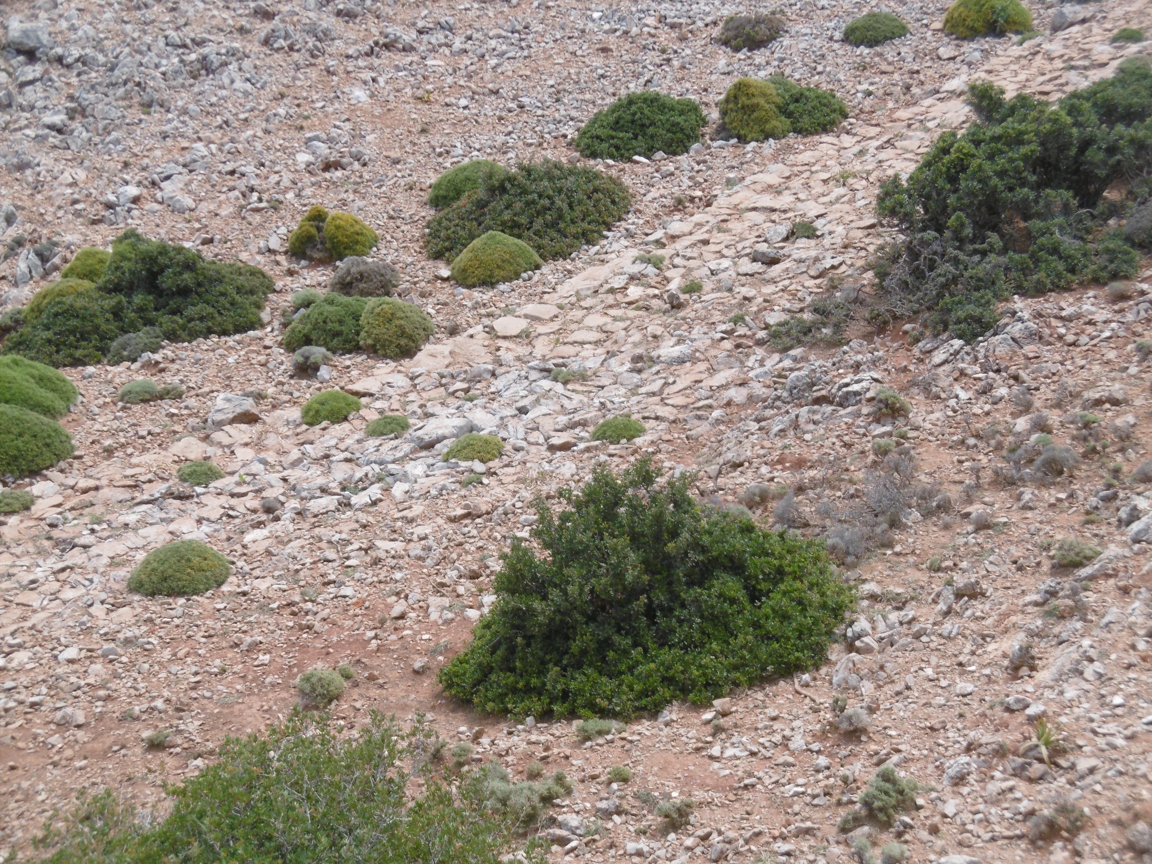
A shrub called thorny cushion attacks exposed flesh below the knee

On approach to the hill, I surprised a goat kid, who put out a call to its mother. The nanny, on the hillside some distance away, returned the call and started down, while their herd-mates expressed displeasure at the unexpected visit. So, to a chorus of bleating goats, I picked my way over uneven terrain, up the hill toward a shadowy opening, avoiding sharp stones, holes, and thorny-cushion shrubs.

Beyond the cave openings are tunnels, blasted out of the stone hill by the Germans. The tunnels extend up to 50 feet straight into the hill. Inside, green moss grows in thin film on the walls near the entrances; a layer of goat droppings covers the floors. Bore holes in the rear of each tunnel give away the digging method: drill a hole a couple feet deep and the diameter of a dynamite stick, insert explosives, stand back and hold your ears, then clear out the rubble.

In front of the tunnels are gun emplacements and various structures I guessed were once headquarters and mess hall. Each emplacement is connected to the next by a man-height trench, also blasted out of solid rock.

Gun emplacement at 3

Gun emplacement at 3., tunnel behind

In all, I counted five tunnels. The trench leading east from the easternmost tunnel, which I refer to as the first or 1., leads to a large hole. Its purpose I could not guess.

In the opposite direction from the first tunnel, the trench leads to a rock slide. Pacing my steps, I counted—roughly, due to difficult footing—forty to fifty paces between each of the other tunnels. However, moving west from the first through the rock slide to the next tunnel, I measured twice the distance. Therefore, I presume the rock slide must cover another tunnel or some such emplacement.

Field sketch

Field sketch showing emplacements around Zovigli’s base

Emplacements from east to west:

0. Hole, trench begins
1. Gun emplacement and tunnel
2. Rock slide (buried emplacement?)
3. Gun emplacement and tunnel
4. Headquarters, tunnels on either side
5. Mess hall and forked tunnel
6. Depot, trench ends, road begins

What I call the “depot” (6.) is the foundation of a small rectangular building. An old track, now grassed over, starts there and goes a hundred feet or so before becoming lost in stones and thorny cushions.

Looking up the west face, it didn’t seem so very far to the top. I was ill equipped for climbing, shod in flat sandals. However, I knew from earlier satellite reconnaissance there was a rectangular structure up there, and this might be my only chance to explore it. So, I screwed on my hat, stuck the Arizonas to my feet, and scrambled to the top.

From Zovigli hilltop

From Zovigli hilltop, 370 meters above, a tour boat rounds the cape

I was alone, but there were witnesses. I reached the pinnacle and looked down. Passengers aboard a tour boat, likely on its way back from the remote beach at Diktynna, must have been saying, “Look, there’s a guy climbing up there!” and “Oh my God, he must be crazy.” I posed for photos.

The rectangular structure may be another wartime construction. Two by three paces in area, five feet high, the four stone block walls and a similar floor are in better shape than the ruins below. In one corner, a two-foot square opening in the floor captures one’s attention. Four rusty rungs set into the stone lead down a few feet. Below that, only a flat rock floats in cool darkness.

Stone block ruins atop Zovigli

Stone block ruins atop Zovigli from above

A debate raged in my head. There was much swearing. I really wanted to see what was down there. I could have descended the rungs and hung a leg down to test the distance to the rock, but if I so much as lost a sandal in that hole, the return hike would be grueling. And much worse than that was well within the realm of possibility. After more minutes than sanity should have allowed, prudence won out.

On the highest rock, there is a cement column, which serves as a geological marker, beside a cairn. The latter indicates the place has been visited by at least a score of other climbers since the Germans left. I found a suitable example to add to its height.

Up there, it was just me and the wind, with the rocks and the sea and the whole world below.

Tell me again, Jonathan Livingston, what is the perfect speed…?

A Bonelli’s eagle

A Bonelli’s eagle, common in Crete

Continue ReadingExploring Zovigli

The Hadrianic Road to Diktynna

P1000594

“Let me out here, Richard. Just around the next bend, the valley opens up. You’ll see an expansive view of the end of the peninsula. Stop there. You and Jean can take some pictures, and I’ll be along in two minutes.”

I was taking friends to Diktynna*, in the Menies Valley on the east coast of Rodopou Peninsula, Crete. I hopped out of the car at the spot I’d located earlier on a satellite image. On the screen, a blurry line ran down a ravine along side the gravel road that leads up the peninsula. I was doubtful, but I had to see what it looked like on the ground.

Two steps took me to the border between road and ravine. I saw it in an instant. I turned back toward the car and motioned Richard to halt. He and Jean dismounted to examine the discovery:

A few dozen meters of a road built by the Roman emperor Hadrian in the second century. 

P1000595

* For more information about Diktynna and the temple ruins there, I recommend this article, The Hadrianic Temple of Diktynna in Crete, by Carole Raddato on her blog Following Hadrian.

Continue ReadingThe Hadrianic Road to Diktynna

Retreat in Crete

“Hey Neil, I’m looking for a quiet place, beautiful surroundings, warm, with lots of sunshine to write for a couple weeks. Do you know of any place like that there in Crete?”

“My neighbors are looking for someone to cat-sit.”

I threw some T-shirts and the Arizonas in a bag. Brought the laptop connection to the Machine, as well. Staying at the home of new friends David and Juliet, a lovely English couple, hospitable, free spirits, big hearts, and 20-year residents of the Kissamos region on the Isle of Myth.

Between furry feline feedings, I visit old friends on the island, explore new-to-me ruins, and translate my recent French title to English.

The photo is from a hill above Potamida, showing the mountains around Topolia Gorge.

View of Topolia Gorge

Continue ReadingRetreat in Crete

Etika Mondo’s Ecological Tree House Village

The Cévennes
The Cévennes

Last week I ventured to the Cévennes in southern France to visit Boris Aubligine and learn about an ambitious project. Boris recently acquired a farm house on six hectares (15 acres) of forest land. During my stay, he shared with me his vision for the place:

Imagine a cabin, designed to minimize energy consumption and made with local lumber, cut using renewable energy. Put the cabin on wooden pillars in a forest. Now imagine a whole village of these cabins, and the inhabitants cultivate the surrounding land for their daily needs.

In-the-trees house

In-the-trees house prototype

Respecting their ecosystem, the trees are left alone. The “tree houses” are built on wooden pillars.

The Etika Mondo eco-site will be a self-sufficient, tree house village, integrated into the local ecology. To make a dream come true, first think of it as only an ambitious project.

On the web: Etika Mondo
Facebook: @etikamondo

“So many of our dreams at first seem impossible, then they seem improbable, and then, when we summon the will, they soon become inevitable.” — Christopher Reeve

A fantastic view

View from the prototype tree house
Continue ReadingEtika Mondo’s Ecological Tree House Village